If you enjoy cruising around on a motorcycle, taking in the beautiful scenery found throughout Vietnam, you will find a plethora of options in the region around Hoi An and Da Nang. The Hai Van Pass was made famous when TV show Top Gear declared it the “most beautiful motorcycle ride”, and since then hundreds of people have visited. A quick Google search for other scenic day trips around Hoi An will reveal a Top 10 list that includes Monkey Mountain and the Son Tra Peninsula, Marble Mountain, and the Ba Na Hills. While all of these are gorgeous and worthy of a trip, we wanted to try something a bit more adventurous and less touristy.
Our destination was the Doi Ngam Bridge, chosen for its location about an hour from Hoi An. We had been wanting to explore the low mountains west of Da Nang, but decided against visiting the tourism hotspot of the Ba Na Hills. Our plan was simple: to ride in a new direction, go a short hike, and return home. But we have found Vietnam to be a land of surprises and even a simple plan can have a twist!
The ride I had mapped out was an easy one, with only a few turns, allowing me to enjoy the scenery. We left around noon on a bright, sunny day towards the end of our month-long trip in Vietnam filled with bright, sunny days. By now, the main streets around Hoi An were familiar. We headed north towards Da Nang, observing daily life as we passed through the outskirts of Vietnam’s fifth-largest city. The freeway we took was at times 6 lanes wide, yet there were only a few vehicles on the road at this time – mainly the ubiquitous Grab ninjas delivering a myriad of food on their mopeds. We saw a few people tending food stalls from the shade of an awning, with customers perched on tiny plastic chairs eating a quick bowl of pho for lunch.
We turned west before we reached the heart of Da Nang. Multi-story buildings gave way to a more rural setting of cropland interspersed with clusters of single level homes. Vietnam is known for its rice paddies, but as we headed away from the lowlands into the hills, we saw fields of corn, cassava, and other vegetables. The sun was hot but our motorcycle was fast and the wind in our hair was cool.
We turned off the freeway and passed through Hoa Phuong, a rural commune (town). We saw a few groups of people at work, clearing overgrowth from the electrical lines, mowing weeds along the roadside, and repainting road markers. Finally we came to the Luong Dong river and turned onto QL14G. This road follows the river all the way up to its source in the foothills of the Annamite mountains, and then continues on to the village of Prao. For us, we planned to go only as far as the Ngam Doi Bridge.
As we rounded a curve in the road, the valley spread out before us in all its glory. The nearby hills were covered with dense, verdant jungle, while above the sun danced among cotton clouds floating in a pure blue sky. The hills rolled off into the distance, where their tops disappeared into a veil of mist. Below it all, the river – more of a wide stream – burbled cheerfully along a bed of rocks worn smooth by the passage of water and time.
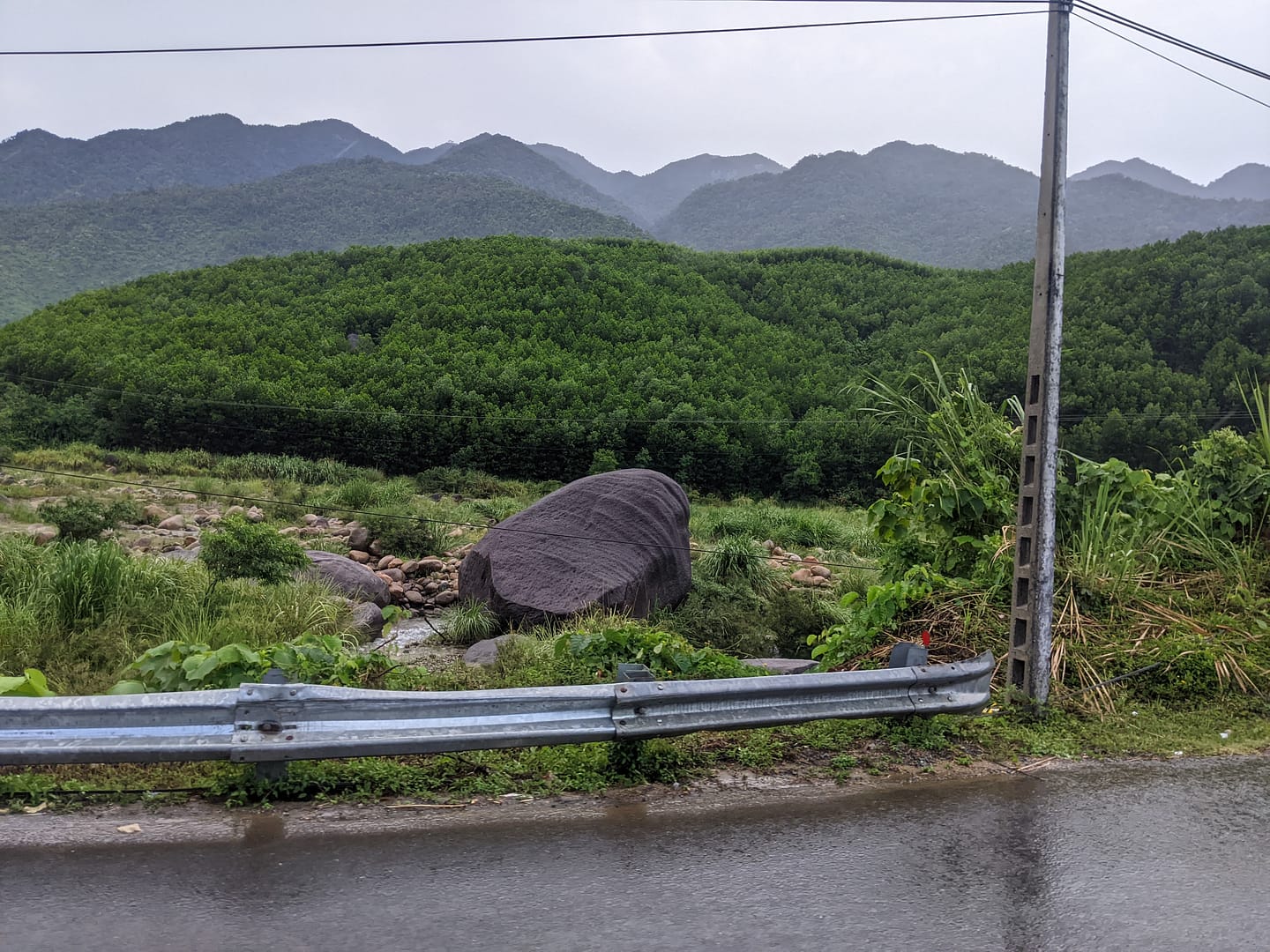
As we continued along the valley, the road following the winding of the river, the rocks became bigger and soon we were seeing massive boulders the size of cows — trucks — whole houses! The rocks were scattered throughout the valley like a giant’s building blocks. This area has been called a “kingdom of granite… with purple-blue rocks sprawling from the foot to the top of the mountain.”
The popular Ba Na Hills are located in the mountains just north of the Luong Dong river, although the entrance to the resort and its cable cars is on the north face of those mountains and accessed by a different road. There are smaller tourism spots along the QL14G as it follows the Luong Dong river: Hot Springs Park, Dinosaur Park, The Green Place, Róc Rách Glamping. Many advertised waterfalls or bathing springs, but these seemed to be man-made structures created with water piped in from the river.
We stopped a short ways from the Doi Ngam bridge to rest and take in the scenery. The bridge was not as impressive as some of the other bridges we’ve seen in Vietnam, but the mountain scenery more than made up for that. The river did not appear very deep and was sprinkled with more of the giant boulders. A natural dam had caused a small pool to form near where we stopped, and a few cows grazed peacefully beside it.
We heard the distant rumble of thunder but decided to press on a bit farther. Now that we were in the mountains, the air was a bit cooler. Joe was enjoying motorbiking along the switchbacks. And so far, the rainstorms we’d encountered had been shortlived.
That was a mistake! A smattering of rain began only ten minutes later. We turned around, but by then we were truly in the center of the storm. The drips turned into a true downpour and we were forced to take shelter in some trees along the side of the road. We were soon drenched through but laughing at our mis-adventure.
Suddenly on the other side of a fence through the trees, we heard “Psst! Hey!” A small Vietnamese woman was crouched over, sheltering from the rain under her triangle hat. She waved us towards an opening in the fence and gestured to some benches under a park shelter. Soon she came over to offer us water, a snack, and see if we needed help. No English was spoken, we used Google translate and smiles. Truly a memorable encounter!
The ride back down the river valley seemed surreal. After 45 minutes of steady rain, the clouds blew over and we continued on our way. The sun came out and immediately steam began to rise from the wet road. We passed a few other motorbikers, all of whom were prepared for the rain and wearing ponchos. We were the only ones soaked through.
On the way back, I spotted a small park with a staircase leading up… and up… and up… to where we could see some sort of obelisk. Curious, I started climbing. 125 stairs later, I turned to look back where I had come from. The entire river valley spread out before us, still steaming from the recent rain shower. What a breathtaking vista!
As it turned out, the obelisk was a memorial, and had an inscription which translated as:
Meditation Stone Hill
– Nguyen Anh Huu –Here is a sacred place.
Located in the middle of the three mountains, a private corner of heaven
The great rocky terrain in the world
A convergence of the spirit born in the present
The tiger sits on high ground and the dragon rolls
Luong Dong River flows through earth and sky.
The mountain god is standing guard on high
One mind, together, to build great karma
For the country and for the people, determined to sacrifice themselves.
The Word inspires the great cause of the nation, the people,
And the people enjoy peace and harmony.
Letters are carved in stone, and we are proud of our lives,
Dedicating our sublime life to the country
A beautiful sentiment. Unfortunately I wasn’t able to find out any more about this memorial. I would welcome a better translation by a native Vietnamese – please leave a comment below.

